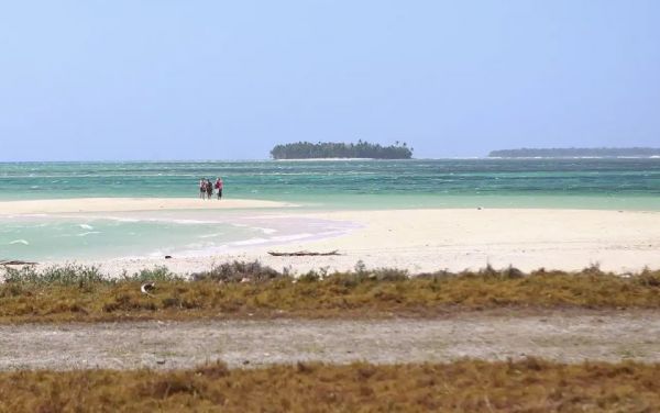

Tsunamis: Kwajalein has a low risk for devastating effects from tsunamis. For a tsunami to produce devastating inundation and damage along coastlines, the sea floor must gradually rise up to the shoreline. This forces the tsunami to slow down and build in height, producing a high amplitude wave that can wash inland and cause significant damage. In contrast, Kwajalein Atoll, along with the other atolls of the Marshall Islands, has an extremely steep drop-off from the reef front into deep ocean waters. This prevents a tsunami from building up and allows them to predominantly pass with little noticeable effect.
However, tsunamis can have an effect on Kwajalein if certain conditions exist. If a powerful tsunami moves through the area at or near high tide, it can move enough water over the Oceanside reef to cause some inundation. In addition, parts of the atoll have large ocean-side reef areas that are shallowly submerged. Should a tsunami come from a direction that allows it to directly impact such a reef area, then some inundation is likely to occur. This occurred during the Tohoku earthquake and tsunami on 11 March 2011, with a 9.0-9.1 magnitude. With the tsunami propagating from the northwest, Roi-Namur and other areas along the northern atoll experienced more inundation from the wave crests than areas further south due to protection of the northern atoll. Island Security reported that boats at the Small Boat Marina hit the bottom as the surge receded inside the lagoon, while there were other reports of damage to the northern shoreline and breakwaters with minor flooding or splash over in some areas.
Tropical Cyclone Threats: The generic term for Tropical Disturbances, Tropical Storms (TS) and Typhoons (TY) is tropical cyclone. Typhoons are classified as tropical cyclones with sustained winds greater than or equal to 64 knots (74 mph), while tropical storms contains winds between 35-63 knots and tropical depressions contain winds between 25-35 knots. Due to Kwajalein’s location, typhoons are rare. Tropical storms and tropical depressions, which are less intense than typhoons, are more frequent.
History of Tropical Cyclones at USAG-KA
In January 1988, TS Roy caused extensive shoreline damage at Kwajalein. Various facilities were damaged, mostly the roofs, with the damage estimated at approximately two million dollars for Kwajalein. Because of the storm’s track, most of the damage was to buildings on the ocean side and the shoreline areas along the runway and golf course. Ebeye received even worse damage, leaving 3,500 people homeless, with major damage to more than 50% of the homes, while 30% were destroyed.
TS Zelda came through Kwajalein on Thanksgiving Day 1991 with 55 knot sustained winds and peak gusts of 71 knots. Zelda’s winds and driving rains uprooted trees and severely damaged many facilities. The center of the storm passed within 19 miles southwest of Kwajalein. The Federal Emergency Management Agency (FEMA) declared Kwajalein Atoll a disaster area with damage totaling more than eight million dollars.
TY Paka passed 83 miles south of Kwajalein on December 12, 1997. Sustained winds of 39 knots were recorded on Kwajalein, with gusts to 47 knots. While damage was widespread, it was generally minor.
In December 2004, TS Talas made its way through the Marshall Islands, affecting Kwajalein Atoll from the evening hours of December 10 through the morning hours of December 11. Talas’ track brought it 16 miles south of Kwajalein. The weather station recorded sustained winds of 40 knots, with gusts to 56 knots. There were a few structures on Kwajalein that sustained significant structural damage; however, the storm’s overall impact was not great. Reports indicated more severe damage on Ebeye, with many roofs blown off and significant structural damage to houses.
TS Bavi formed in the RMI in March 2015 and moved within 111 miles southwest of Kwajalein. The Kwajalein Atoll experienced several days of blustery winds in excess of 25 knots with several short peaks of sustained winds over 34 knots. The maximum sustained wind speed was 36 knots with a maximum-recorded gust of 44 knots. TS Bavi damaged the roofs on several buildings, toppled trees, and did damage at both Roi-Namur and Kwajalein. Damage was estimated to be more than a million dollars.
During strong warm water events (El Nino), the general region for tropical cyclone formation shifts eastward, increasing the likelihood of tropical cyclone activity throughout the Marshall Islands. This can have other effects as well. For example, a disturbance forming west of Kwajalein may cause a period of west winds. The lagoon geography allows westerly winds to pile up water on the lagoon shores of Kwajalein and Roi-Namur Islands, resulting in unusually high surf and wash-over in low-lying areas. Structures such as docks, boats and housing, which are usually sheltered from easterly trade winds, become vulnerable to damage during these conditions. In 2008 and again in 2015, harbor docks and boats were significantly damaged by lagoon waves during west wind swell episode. In addition, rough seas along the watercraft traffic channels in the lagoon hinder transport capabilities, disrupt logistics, and limit safe commutes of the Marshallese workforce.